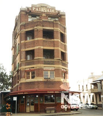
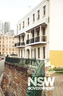
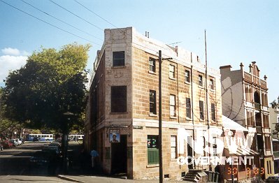
Subject: Hotels of the village: the Palisade Hotel, Bettington Street, on Old Millers Point.
Photographer: Bruce Baskerville
Copyright owner: Crown - NSW Heritage Office
Date: 25/10/2003
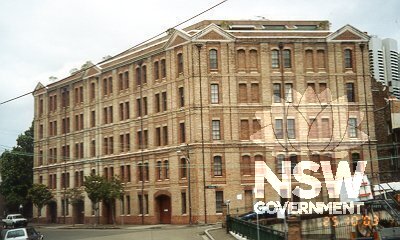
Subject: Oswald Bond Store, Windmill Street, overlooking the Hickson Road cutting
Photographer: Bruce Baskerville
Copyright owner: Crown - NSW Heritage Office
Date: 25/10/2003
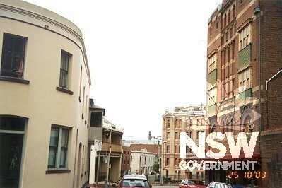
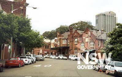
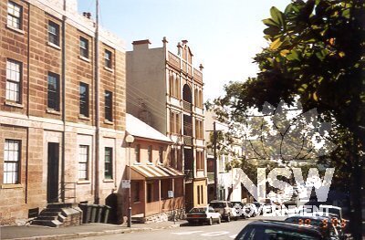
Subject: Vista along Bettington Street, from corner of Merriman Street, with Palisade Hotel on right, Oswald Bond Store in mid-ground, showing scale of the Old Millers Point area of the precinct.
Photographer: Bruce Baskerville
Copyright owner: Crown - NSW Heritage Office
Date: 25/10/2003
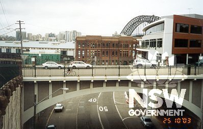
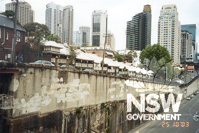
Subject: View from Bettington Street bridge over Hickson Road towards Windmill Street bridge, with Old Millers Point area on the left, indicating dramatic changes in the landscape in early 20th century.
Photographer: Bruce Baskerville
Copyright owner: Crown - NSW Heritage Office
Date: 25/10/2003
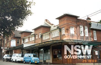
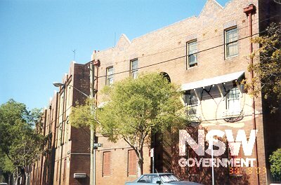
Subject: Vista eastwards along Argyle Street showing shops built by Sydney Harbour Trust in 1910, an example of the facilities provided to retain wharf labourers in the vicinity.
Photographer: Bruce Baskerville
Copyright owner: Crown - NSW Heritage Office
Date: 25/10/2003
Subject: Argyle Street shops, built by Sydney Harbour Trust in 1910.
Photographer: Bruce Baskerville
Copyright owner: Crown - NSW Heritage Office
Date: 25/10/2003
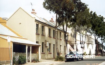
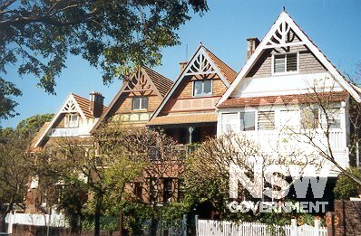
Subject: Housing on the east side of Merriman Street, Old Millers Point, dating from c1870s
Photographer: Bruce Baskerville
Copyright owner: Crown - NSW Heritage Office
Date: 25/10/2003
Subject: Housing on east side of Merriman Street, near corner with Bettington Street.
Photographer: Bruce Baskerville
Copyright owner: Crown - NSW Heritage Office
Date: 25/10/2003
Subject: Housing in Dalgety Terrace, built by Sydney Harbour Trust for wharf families.
Photographer: Bruce Baskerville
Copyright owner: Crown - NSW Heritage Office
Date: 25/10/2003
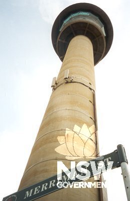
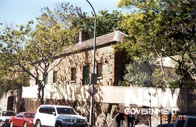
Subject: The Port Operations and Communication Centre, built in the early 1970s and known locally as The Pill.
Photographer: Bruce Baskerville
Copyright owner: Crown - NSW Heritage Office
Date: 25/10/2003
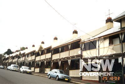
Subject: Flats in High Street, stepping down the slope of the street
Photographer: Bruce Baskerville
Copyright owner: Crown - NSW Heritage Office
Date: 25/10/2003
Subject: Flats in High Street, built by Sydney Harbour Trust in 1910
Photographer: Bruce Baskerville
Copyright owner: Crown - NSW Heritage Office
Date: 25/10/2003
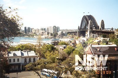
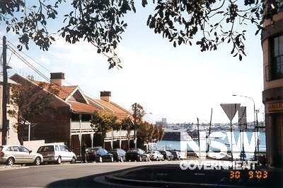
Subject: View over Dawes Point quarter from Observatory Hill.
Photographer: B. Baskerville.
Copyright owner: Heritage Office
Date: 10/09/2003
Subject: Ferry Lane, Dawes Point, looking northwards from Lower Fort Street, the site of the outbreak of the plague in 1900.
Photographer: B. Baskerville
Copyright owner: Heritage Office
Date: 10/09/2003
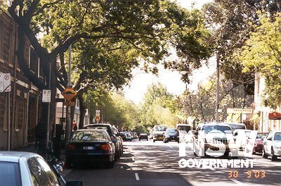
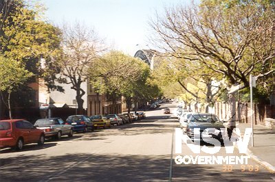
Subject: Principal thoroughfares of the village: Kent Street, looking northwards from the southern boundary of the precinct.
Photographer: B. Baskerville
Copyright owner: Heritage Office
Date: 10/09/2003
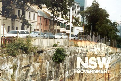
Subject: Stone boundary wall of Dawes Point Park, along Lower Fort Street, marking the north eastern boundary of the precinct.
Photographer: B. Baskerville
Copyright owner: Heritage Office
Date: 10/09/2003
Subject: Principal thoroughfares of the village: Lower Fort Street looking northwards from Argyle Place - note the old tram lines still evident in the road surface.
Photographer: B. Baskerville
Copyright owner: Heritage Office
Date: 10/09/2003
Subject: Principal cross streets of the village: High Street, Millers Point, looking westwards from Kent Street into Darling Harbour.
Photographer: B. Baskerville
Copyright owner: Heritage Office
Date: 10/09/2003
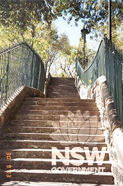
Subject: Looking up Agar Steps, a scene representative of the steep topography and walking scale of the village.
Photographer: B. Baskerville
Copyright owner: Heritage Office
Date: 10/09/2003
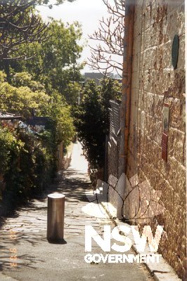
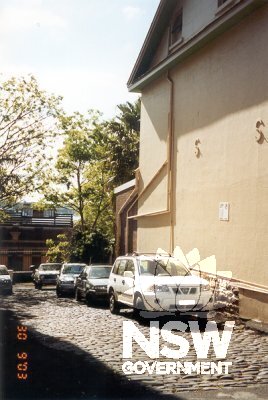
Subject: Downshire Place, Dawes Point - a typical lane scene in the Dawes Point quarter.
Photographer: B. Baskerville
Copyright owner: Heritage Office
Date: 10/09/2003
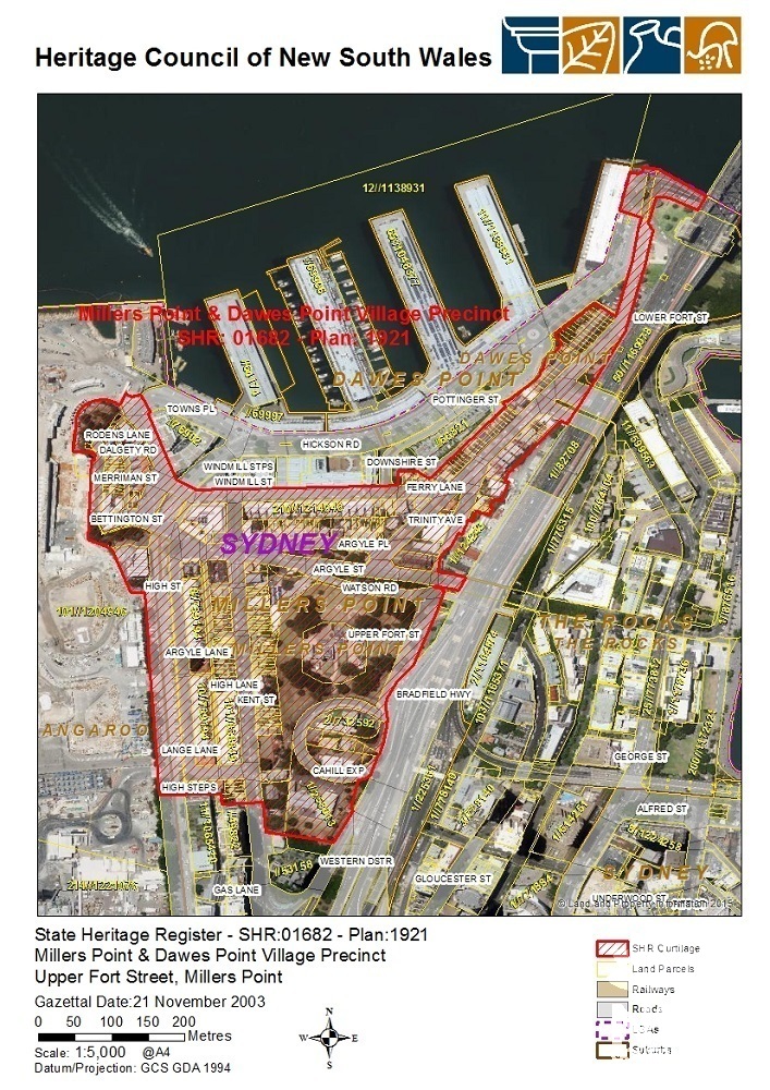
Subject: SHR Plan 1921
Photographer: Heritage Division
Copyright owner: Heritage Council of NSW
Date: 23/11/2003
Subject: Housing on east side of Bettington Street, viewed from Clyne Reserve across cutting made in 1970s
Photographer: Bruce Baskerville
Copyright owner: Crown - NSW Heritage Office
Date: 25/10/2003
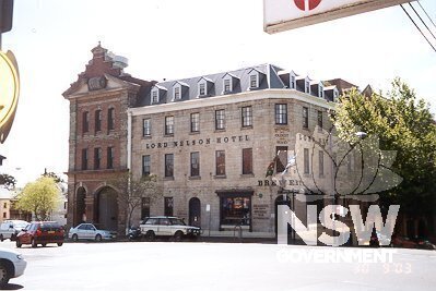
Subject: Hotels of the village: Lord Nelson Hotel, corner Kent and Argyle streets, Millers Point.
Photographer: B. Baskerville
Copyright owner: Heritage Office
Date: 10/09/2003
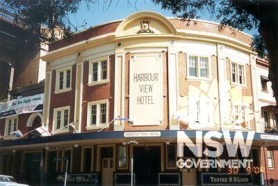
Subject: Hotels of the village: Harbour View Hotel, cnr. Lower Fort and Cumberland streets, Dawes Point
Photographer: B. Baskerville
Copyright owner: Heritage Office
Date: 10/09/2003
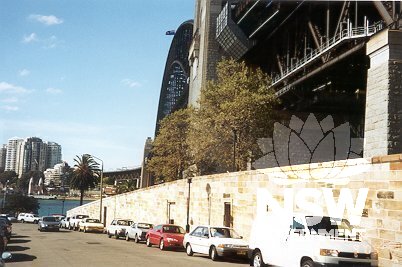
Subject: The High Street cutting, with Hickson Road below, showing the V shape of the High Street level
Photographer: Bruce Baskerville
Copyright owner: Crown - NSW Heritage Office
Date: 25/10/2003
Subject: Hotels of the village: Hero of Waterloo Hotel, corner of Lower Fort and Windmill streets, Dawes Point.
Photographer: B. Baskerville
Copyright owner: Heritage Office
Date: 10/09/2003
Subject: Bligh House, Lower Fort Street, Dawes Point - an example of merchant housing in the village, built 1824 and previously known as Holbeck and St Elmo.
Photographer: B. Baskerville
Copyright owner: Heritage Office
Date: 10/09/2003
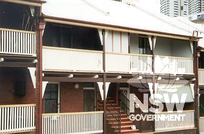
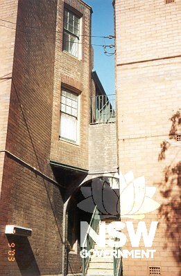
Subject: Public Housing, 30-42 Lower Fort Street - built by Sydney Harbour Trust c1915
Photographer: B. Baskerville
Copyright owner: Heritage Office
Date: 10/09/2003
Subject: Detail of stairs connecting the flat buildings at 30-42 Lower Fort Street, Dawes Point.
Photographer: B. Baskerville
Copyright owner: Heritage Office
Date: 10/09/2003
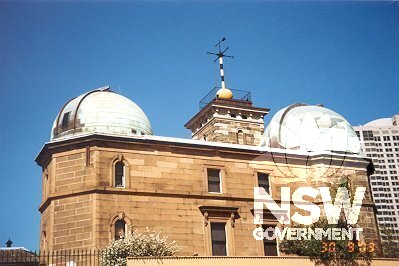
Subject: Public buildings of the village - the Sydney Observatory on Observatory Hill, on the site of Fort Phillip, designed by Blackett in 1857.
Photographer: B. Baskerville
Copyright owner: Heritage Office
Date: 10/09/2003
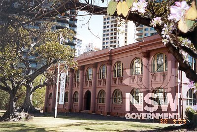
Subject: Public buildings of the village - Ervin Gallery, National Trust Centre, facing the Bradfield Highway - formerly the military hospital and then Fort Street School.
Photographer: B. Baskerville
Copyright owner: Heritage Office
Date: 10/09/2003
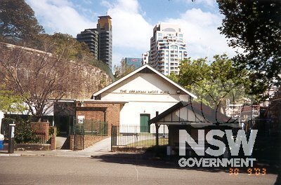
Subject: Public buildings of the village - Abraham Mott Hall (formerly the Coal Lumpers Hall), Argyle Street.
Photographer: B. Baskerville
Copyright owner: Heritage Office
Date: 10/09/2003
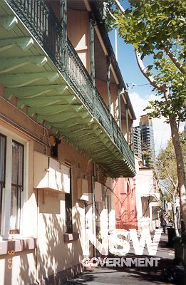
Subject: Streetscape character of Millers Point - cantilevered balconies, narrow footpath, sandstone kerbing, with skyscrapers on skyline - Kent Street.
Photographer: B. Baskerville
Copyright owner: Heritage Office
Date: 10/09/2003
Subject: Public buildings of the village - Rawson Hall, Kent Street
Photographer: B. Baskerville
Copyright owner: Heritage Office
Date: 10/09/2003
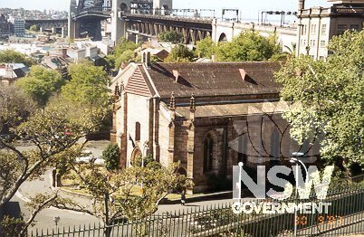
Subject: Public buildings in the village - Holy Trinity (Garrison) Anglican Church, built 1840, corner of Lower Fort Street and Argyle Place.
Photographer: B. Baskerville
Copyright owner: Heritage Office
Date: 10/09/2003
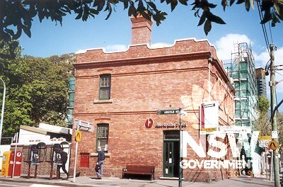
Subject: Public buildings of the village - Millers Point Post Office, corner of Kent Street and Argyle Street.
Photographer: B. Baskerville
Copyright owner: Heritage Office
Date: 10/09/2003
Subject: View along Windmill Street, showing south side of street, from corner of Lower Fort Street - the north side of the street marks the northern boundary of the precinct.
Photographer: B. Baskerville
Copyright owner: Heritage Office
Date: 10/09/2003
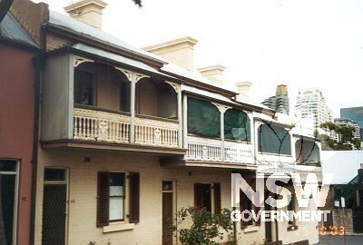
Subject: Public housing in the village, Lower Fort Street, Dawes Point
Photographer: B. Baskerville
Copyright owner: Heritage Office
Date: 10/09/2003
Subject: Glovers Cottages, Kent Street, built in the early 1820s and the oldest house in Millers Point.
Photographer: B. Baskerville
Copyright owner: Heritage Office
Date: 10/09/2003
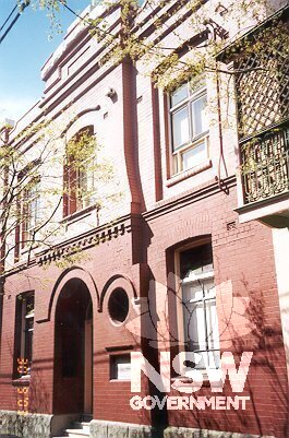
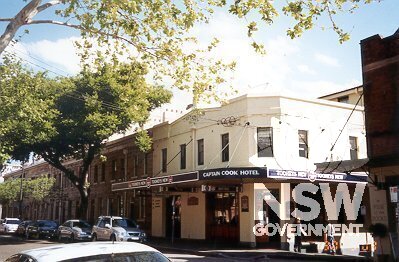
Subject: Hotels of the village: Captain Cook Hotel, corner Kent Street and High Lane, Millers Point.
Photographer: B. Baskerville
Copyright owner: Heritage Office
Date: 10/09/2003
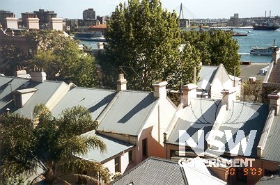
Subject: View over rooftops of southern Millers Point from Observatory Hill.
Photographer: B. Baskerville
Copyright owner: Heritage Office
Date: 10/09/2003